Project Overview (2022-2023)
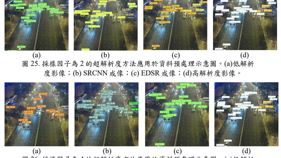
This project was a comprehensive survey and investigation into improving the resolution of drone-based aerial images using super-resolution techniques. It served as a subproject of the NSTC-Research Project titled "Deep Learning-based Multi-Task Super-Resolution Imaging Technology."
Key Focus Areas
- UAV Constraints: Analyzing the limitations of drone hardware and transmission bandwidth.
- Small Object Detection: Improving the detection accuracy of small objects in aerial views through resolution enhancement.
- Real-world Application: Evaluating the feasibility of deployment on edge devices for real-time processing.
Research Context
Subproject of NSTC-Research Project: 基於深度學習的多任務超解析成像技術 - 以衛星、空拍及路側影像應用為例